Motorcycle Man Road Guide
The Best Motorcycle Rides in Texas
Nine unforgettable routes—with starting points, destinations, biker-friendly stops and the best time of year to ride.
The Open Road Is Calling
Texas Was Made to Be Explored on Two Wheels
In a single state, riders can carve through limestone canyons, follow the Rio Grande across the Chihuahuan Desert, climb into cool mountain air, roll beneath towering East Texas pines and finish a coastal ride aboard a ferry crossing Galveston Bay.
The hard part is not finding somewhere to ride. It is choosing which road deserves your next open weekend.
Here are nine of the best motorcycle rides in Texas, including where to start, where to finish, what roads to follow, interesting stops along the way and the best time of year to make each trip.
01
Texas Hill Country
The Twisted Sisters: Texas’ Most Famous Motorcycle Route
If Texas has a signature motorcycle ride, this is it.
The Twisted Sisters combine steep climbs, tight turns, sweeping curves, river crossings and long stretches of isolated Hill Country pavement. This is not a casual cruise for riders who are uncomfortable with blind corners or quickly changing elevation.
A popular clockwise route begins in Leakey. Take Ranch Road 336 north to Highway 41, travel west to Ranch Road 335, follow 335 south toward Barksdale, connect with Highway 55 into Camp Wood and then ride Ranch Road 337 east back to Leakey.
Interesting Stops
- Frio Canyon Motorcycle Stop and Bent Rim Grill: A natural starting or ending point with food and plenty of other riders.
- Camp Wood: A good fuel, food and rest stop.
- Nueces River overlooks: Dramatic views of the river valley and canyon walls.
- Lost Maples State Natural Area: A worthwhile fall-color detour.
- Garner State Park and the Frio River: An easy addition to a full weekend.
Why Riders Love It
The Twisted Sisters require your attention. Some turns tighten unexpectedly, elevation changes can hide what is ahead and open-range livestock may appear near or directly on the road.
That challenge is precisely why experienced riders return. Spring provides green hills and wildflowers. Late October and November bring cooler temperatures and the possibility of fall color around Lost Maples. Summer can be extremely hot and river-season traffic becomes heavier.
02
Big Bend Country
FM 170 Through Big Bend: The River Road
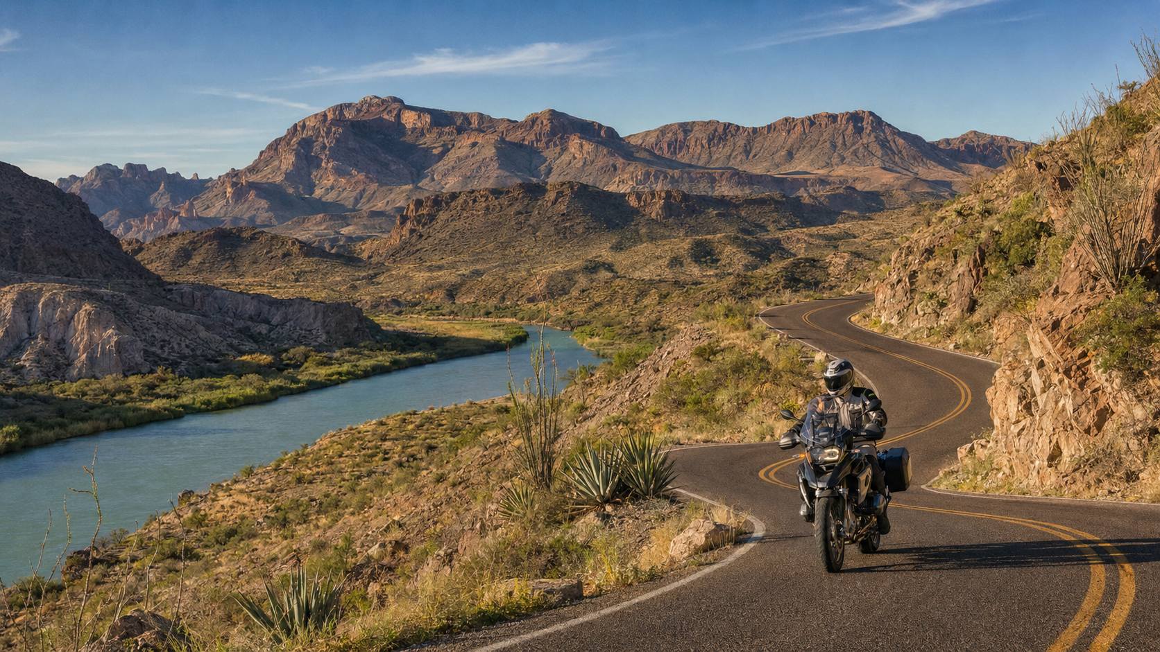
FM 170 · Big Bend River Road
FM 170 between Presidio and the Big Bend communities of Lajitas, Terlingua and Study Butte is one of the most visually dramatic paved roads in Texas.
The road follows the Rio Grande through Big Bend Ranch State Park, climbing above the river before dropping into canyons, arroyos and wide-open desert. At several points, Mexico is only a short distance across the water.
Start in Presidio with a full tank and follow FM 170 southeast toward Lajitas and Terlingua.
Interesting Stops
- Fort Leaton State Historic Site: A restored adobe trading post outside Presidio.
- Big Hill Overlook: One of the route’s best panoramic views.
- Closed Canyon: A short slot-canyon hike just off FM 170.
- The Hoodoos: Unusual balanced-rock formations and river views.
- Barton Warnock Visitor Center: Learn about the region and confirm park conditions.
- Lajitas and Terlingua: Fuel, food, old mining ruins and a memorable sunset.
Remote-Ride Reminder
Prepare for the Isolation
Cellular service is unreliable, fuel is limited and summer heat can become dangerous very quickly. Carry water, a tire-repair kit, basic tools and an offline or paper map. Avoid low-water crossings when storms are in the area.
03
West Texas Mountains
The Davis Mountains Scenic Loop
The Davis Mountains Scenic Loop offers an entirely different picture of West Texas.
Beginning in Fort Davis, riders climb Texas 118 through Limpia Canyon and continue toward the McDonald Observatory. The route then travels through high-elevation grasslands and mountain gaps before turning onto Texas 166 and eventually returning to Fort Davis on Texas 17.
The elevation, cooler air, pine-covered slopes and mountain views can make the area feel far removed from the surrounding desert.
Interesting Stops
- Fort Davis National Historic Site: A remarkably preserved frontier military post.
- Davis Mountains State Park: Overlooks, trails and the historic Indian Lodge.
- McDonald Observatory: Take the Spur 78 detour to the visitor center.
- Madera Canyon: A peaceful high-elevation place to stretch.
- Point of Rocks: A scenic roadside picnic location.
- Downtown Fort Davis: Finish with a meal, coffee or an overnight stay.
Why Riders Love It
The road combines mountain curves with longer sections through open grasslands. Spring and fall generally deliver the best conditions. Summer afternoons may bring heat and thunderstorms, while winter cold fronts can produce freezing temperatures or ice at higher elevations. Fuel up in Fort Davis before beginning the loop.
04
Hill Country Half-Day Ride
The Devil’s Backbone
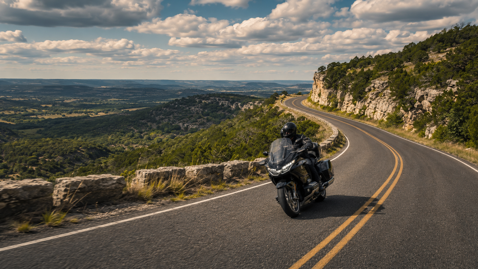
Ranch Road 32 · Devil’s Backbone
The Devil’s Backbone is shorter than the Twisted Sisters, but it delivers an excellent combination of Hill Country curves, limestone ridges and scenic overlooks.
Begin in Wimberley, travel south on Ranch Road 12 and then turn west onto Ranch Road 32. The route follows a narrow ridge along the Balcones Escarpment before reaching U.S. 281 and Blanco.
This is a good choice for a relaxed half-day ride or as one section of a longer Hill Country weekend.
Interesting Stops
- Wimberley Square: Start with coffee or breakfast.
- Devil’s Backbone Scenic Overlook: Enjoy an expansive Hill Country view.
- Devil’s Backbone Tavern: A legendary roadside stop near Fischer.
- Blanco State Park: Cool down beside the Blanco River.
- Historic Blanco Courthouse Square: Finish with lunch or a walk downtown.
Why Riders Love It
The route has enough curves to remain interesting without demanding an entire day. It connects easily with Canyon Lake, Johnson City, Luckenbach and Fredericksburg. Spring wildflowers make March and April especially attractive, while October and November usually bring comfortable temperatures.
05
Wildflower Country
Willow City Loop and Enchanted Rock
Willow City Loop is a short but exceptionally scenic Hill Country road northeast of Fredericksburg. During a strong wildflower season, bluebonnets, Indian paintbrushes and other native flowers cover the surrounding ranchland.
Use Fredericksburg as your base, travel north on Texas 16 and incorporate the 13-mile Willow City Loop into a larger ride that includes Ranch Road 965 and Enchanted Rock State Natural Area.
Interesting Stops
- Fredericksburg: Begin with breakfast and a full tank.
- Willow City: A tiny community at the southern end of the loop.
- Willow City Loop: Rugged canyons, ranchland and famous wildflowers.
- Enchanted Rock: Reserve admission in advance if you plan to enter.
- Luckenbach: Add a detour for live music and refreshments.
06
Texas Panhandle
Palo Duro and the Panhandle Canyon Loop
FINISHAmarillo
The Texas Panhandle may look flat from the interstate, but this route proves otherwise.
Leave Amarillo on U.S. 287 toward Clarendon. Turn south on Texas 70, continue on Texas 256 toward Silverton and then follow Texas 86 and Texas 207 north through the canyon country. From Claude, U.S. 287 returns you to Amarillo.
Texas 207 is the visual highlight, cutting through colorful canyon walls and offering broad views across the Panhandle.
Interesting Stops
- Goodnight Ranch State Historic Site: Discover a major chapter of Texas ranching history.
- Clarendon and the Saints’ Roost Museum: Fuel and local history.
- Silverton: Stop before turning north through canyon country.
- Texas 207 overlooks: Views across layered red canyon walls.
- Palo Duro Canyon State Park: Ride the paved park road down into the canyon.
- Caprock Canyons State Park: A worthwhile detour toward Quitaque.
Watch the Weather
Panhandle Wind Deserves Respect
Check the forecast before leaving and be prepared for strong crosswinds, blowing dust, wildlife and agricultural vehicles. Heavy rain can also leave sand or debris on canyon roads.
07
Houston-Area Favorite
FM 149 Through the Sam Houston National Forest
Houston-area riders do not have to travel all the way to the Hill Country to find a rewarding stretch of pavement.
FM 149 begins near historic Montgomery and winds north through the Sam Houston National Forest toward Richards and Anderson. The road offers tall pines, shaded curves, rolling farmland and very few traffic signals.
Ride it as a 60- to 70-mile out-and-back trip or connect it with FM 3090 and surrounding Grimes County roads for a longer loop.
Interesting Stops
- Historic Montgomery: Breakfast, coffee and fuel.
- Lone Star Hiking Trail trailheads: Safe opportunities to stop and stretch.
- Drifters Ice House in Richards: A popular gathering place.
- Historic Anderson: See the courthouse and small downtown.
- Yankee’s Tavern in Carlos: Add this established motorcycle destination to a longer ride.
Why Riders Love It
FM 149 is close enough to Houston for a spontaneous morning ride but still provides a genuine change of scenery. Spring brings wildflowers, while fall offers cooler temperatures. Watch for deer, slow farm vehicles, driveways and several curves that become tighter than they initially appear.
08
Salt Air and Open Views
The Texas Gulf Coast Run
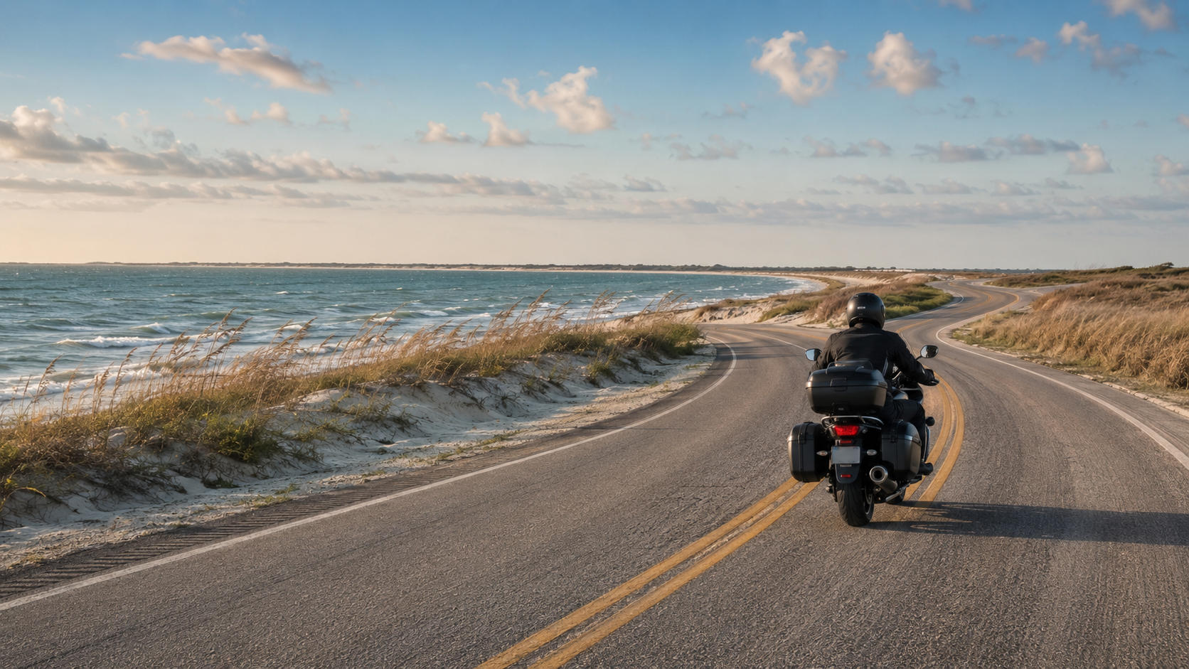
Surfside to High Island · Texas Gulf Coast
This route replaces hills and canyons with salt air, beach views and a ferry crossing.
Begin in Surfside Beach and follow the Bluewater Highway northeast across San Luis Pass onto Galveston Island. Continue along Seawall Boulevard, ride through Galveston and board the Galveston–Port Bolivar Ferry. Once across the bay, follow Texas 87 through Crystal Beach and the Bolivar Peninsula toward High Island.
Interesting Stops
- Surfside Beach: Begin near the water before traffic and temperatures increase.
- San Luis Pass: Stop only in designated safe areas.
- Galveston Seawall: Cruise along the Gulf and stop for lunch.
- The Strand: Explore Galveston’s historic district.
- Galveston–Port Bolivar Ferry: A toll-free crossing with possible dolphin and ship views.
- Fort Travis, Crystal Beach and High Island: History, food and coastal scenery.
Plan Ahead
Skip Peak Summer Weekends
Holiday ferry waits can exceed two hours. Coastal wind, blowing sand, salt spray, thunderstorms and tropical weather all deserve attention. Check the ferry wait time and weather before committing to the route.
09
Piney Woods
The East Texas Piney Woods and Caddo Lake Ride
East Texas offers something completely different from the rocky Hill Country and open West Texas desert.
FM 134 travels north from Waskom through shaded farmland, rolling hills, bayous and small communities before reaching historic Jefferson. The route includes relaxed curves and several tighter turns beneath a canopy of pine and hardwood trees.
Extend the ride with a detour to Caddo Lake State Park or the waterfront community of Uncertain.
Interesting Stops
- T.C. Lindsey & Co. General Store: A historic country store in Jonesville.
- Caddo Lake State Park: Bald cypress trees, Spanish moss and an unusual lake environment.
- Uncertain: A small waterfront community worth the detour.
- Historic Jefferson: Big Cypress Bayou, historic buildings and local restaurants.
- Auntie Skinner’s Riverboat Club: A longtime Jefferson stop popular with riders.
Why Riders Love It
The Piney Woods ride is slower and more relaxed than the Twisted Sisters, but shaded pavement, bayou crossings and historic towns give it plenty of character. Watch for pine needles, wet leaves and shaded patches of damp pavement, especially after rain.
Plan the Calendar
When Is the Best Time to Ride a Motorcycle in Texas?
There is no single motorcycle season for a state this large.
A mild morning in the mountains can become a dangerously hot afternoon in the desert. Check conditions for the entire route—not just the starting town.
Before You Leave
Prepare for the Road You Cannot Predict
The best road trip is the one that ends safely.
Check your tires, brakes, lights, fluids and luggage before departure. Download offline directions, carry water and top off the tank whenever traveling through remote areas. Let someone know your route and expected arrival time.
Never let a group’s pace force you to ride beyond your ability. There is no trophy waiting at the end of the road for the rider who took unnecessary chances getting there.
Expect These Texas Road Hazards
- Deer and other wildlife near dawn and dusk
- Open-range cattle and livestock
- Gravel at intersections and in curves
- Low-water crossings after heavy rain
- Farm equipment and slow-moving vehicles
- Limited cellular service
- Drivers crossing the centerline on blind curves
- Sudden stops near popular scenic overlooks
Ride Texas
Texas Roads Are Better on Two Wheels
From the tight turns of the Twisted Sisters to the vast desert scenery along FM 170, Texas gives motorcyclists enough memorable roads to fill years of weekends.
Choose the route that matches your experience, prepare the motorcycle, watch the weather and leave enough time to enjoy the places between the starting point and the finish.
Because the best Texas motorcycle ride is rarely about reaching the destination first. It is about everything you see—and every mile you experience—along the way.
When Another Driver Ruins the Ride
Motorcycle Cases Are Not Small Car Accident Cases
Even the most prepared motorcyclist cannot control a driver who crosses the centerline, turns left without looking, follows too closely or pulls onto the highway without seeing the motorcycle.
If a driver causes a crash during your Texas motorcycle trip, document the scene if you are physically able. Photograph the vehicles, road surface, traffic signs, skid marks, riding gear and surrounding sightlines. Obtain witness information and seek medical attention, even if the full extent of the injuries is not immediately clear.
The Motorcycle Man understands how insurance companies try to blame riders or minimize their injuries. We are prepared to tell the evidence story before the other driver’s version becomes the only one anyone hears.