Ride Texas High Country
Davis Mountains Scenic Loop
A high-desert motorcycle ride through sweeping curves, rugged peaks, dark-sky country, and some of the most beautiful isolation in Texas.
A Different Side of Texas
The Road Rises Above the Desert
Texas does not give up its mountains easily. You have to ride deep into West Texas, beyond the interstates and crowded cities, before the horizon begins to rise and the road starts folding into the landscape.
That is where you find the Davis Mountains Scenic Loop. Centered around the small town of Fort Davis, this approximately 75-mile route follows Texas highways 118 and 166 through high-desert grasslands, volcanic peaks, shaded canyons, and some of the most isolated riding country in the state.
We included the Davis Mountains in our guide to the Best Motorcycle Rides in Texas, but this route deserves a closer look of its own.
The Route
One Loop. Two Distinct Roads.
Ride it in either direction. Each side of the loop brings a different rhythm, view, and kind of West Texas solitude.
Begin in Fort Davis
Fill the tank, download an offline map, check the weather, and begin from one of the highest-elevation towns in Texas.
Climb Highway 118
Follow the curves into higher country toward Davis Mountains State Park and the McDonald Observatory.
Turn onto Highway 166
Settle into the quieter side of the loop, where narrow pavement and open ranchland wrap around the mountains.
Return to Fort Davis
Complete the loop back in town, where fuel, food, and a slower West Texas pace are waiting.
Highway 118
Climbing Toward the McDonald Observatory
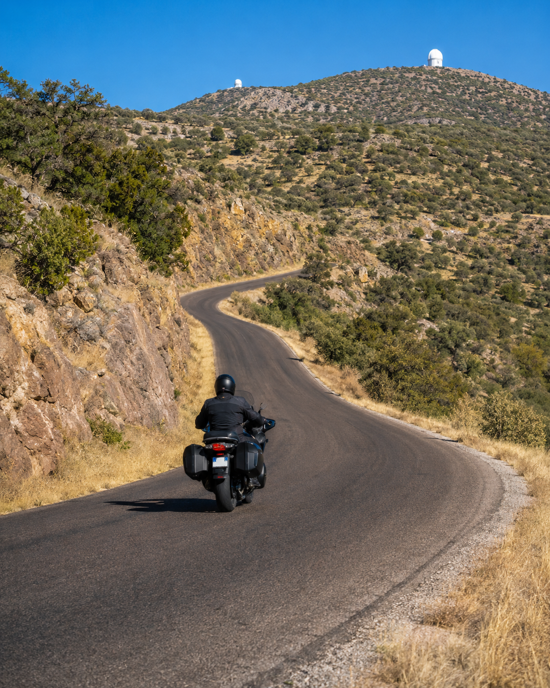
Leaving Fort Davis on Highway 118, the road begins climbing almost immediately. Open ranchland gradually gives way to steeper slopes, exposed rock, oak, juniper, and pine. Long views across the desert appear between the curves.
Highway 118 delivers the most recognizable mountain riding on the loop. Its curves are entertaining without becoming relentlessly technical, and the elevation makes the road feel far removed from the flat highways found across much of Texas.
Worth the Stop: McDonald Observatory
Located about 16 miles from Fort Davis, the observatory sits high on Mount Locke beneath some of the darkest skies in the continental United States. Check the program schedule before your ride; popular evening events may require advance reservations.
Plan an Observatory VisitThe Davis Mountains are not simply a road you complete. They are a place you experience—one curve, one ridge, and one enormous West Texas view at a time.
Highway 166
The Quiet Side of the Loop
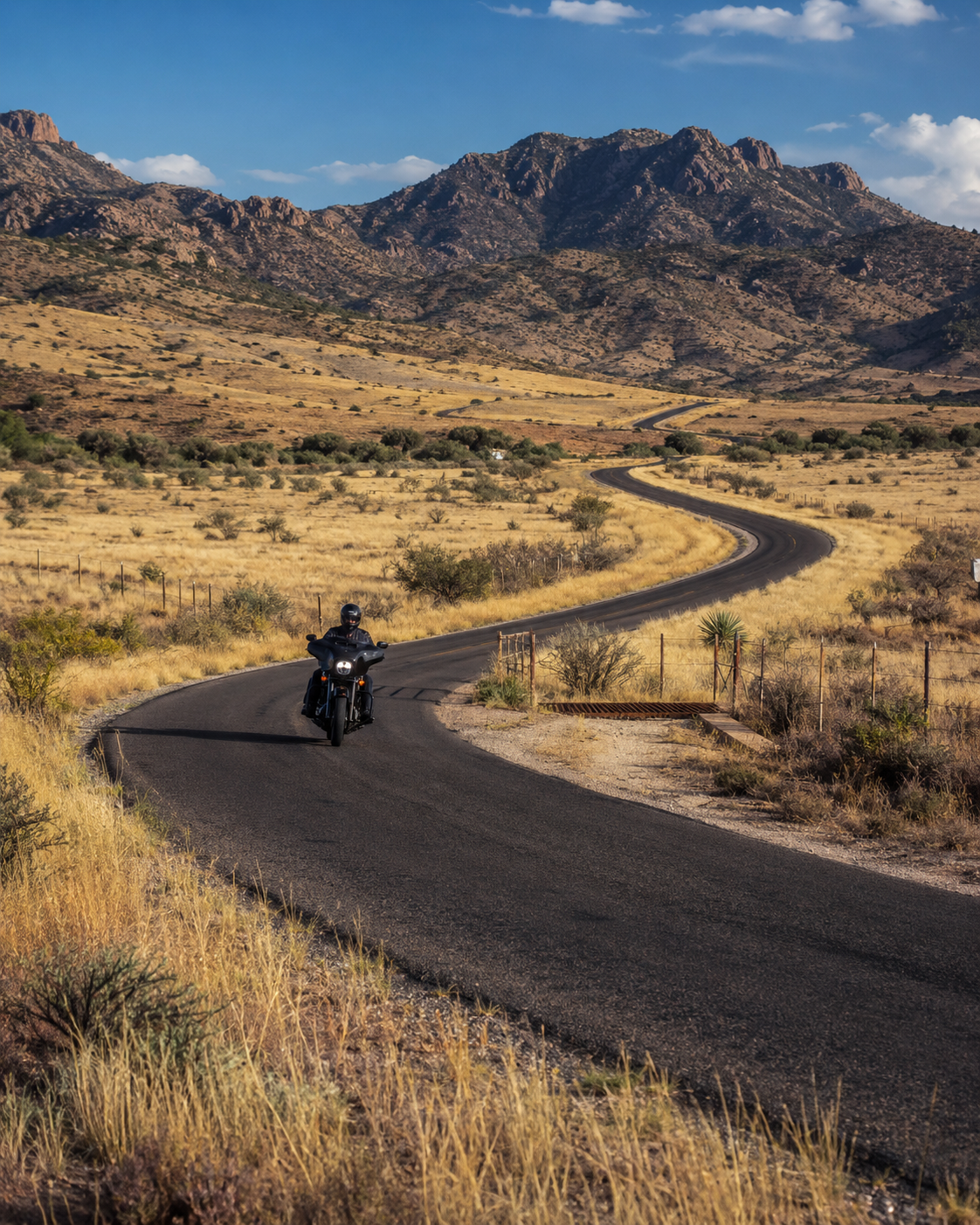
Highway 166 gives the Davis Mountains ride a different personality. The road becomes narrower and more isolated as it curves around the southwestern side of the mountains. Traffic is often light, and long stretches pass through private ranch country with few buildings or services.
The highway moves through open valleys, past rocky ridges, and around the slopes near Mount Livermore. Depending on the season, the landscape may be green and surprisingly lush or covered in the gold and brown colors of the high desert.
- Expect limited or nonexistent cell service.
- Watch for livestock, wildlife, and cattle guards.
- Look for gravel near shoulders and ranch entrances.
- Leave enough daylight to finish without rushing.
Ride Prepared
Remote Roads Reward Good Planning
The isolation is part of the appeal. It also means every rider should arrive ready to be self-sufficient.
Fuel First
Fill up in Fort Davis. Do not depend on finding fuel once you are committed to the loop.
Carry a Map
Download directions for offline use and consider carrying a paper map as a backup.
Watch the Weather
Temperatures, wind, rain, and visibility can change quickly at higher elevations.
Inspect Your Gear
Check tires, brakes, lights, fluids, layers, and drinking water before leaving town.
Mountain Weather
Warm in Town Does Not Mean Warm on the Ridge
Strong crosswinds, sudden rain, fog, and thunderstorms can change the ride with little warning. After a storm, expect the possibility of dirt, gravel, or small rocks on the pavement. Layered riding gear is usually more useful than dressing only for the temperature in Fort Davis.
Make It a Weekend
Places to Explore Around the Ride
Davis Mountains State Park
Scenic overlooks, hiking trails, camping, and the historic Indian Lodge make the park an easy addition to the loop.
Visit the State ParkFort Davis Historic Site
Explore one of the Southwest’s best-preserved frontier military posts and the history of the San Antonio–El Paso Road.
Explore Fort DavisMarfa & Alpine
Add food, lodging, art, and more miles of open West Texas highway by extending the ride to these neighboring towns.
Balmorhea State Park
If time allows, plan a side trip toward the park’s historic spring-fed pool. Check reservations and conditions in advance.
Check Park InformationIf the Ride Goes Wrong
Remote Roads Can Complicate a Motorcycle Accident
Call 911 if you can obtain service and give dispatchers the clearest location possible. Highway numbers, intersections, mile markers, landmarks, and GPS coordinates can help responders find you.
If you are physically able, photograph the roadway, vehicles, skid marks, debris, signs, and surrounding conditions. Get witness contact information, and do not allow important motorcycle parts or riding gear to be discarded before they can be documented.